Banner
Title
Vision Zero Santa Barbara
Body
A Smarter Way to Approach Traffic Safety!
Sections

Vision Zero is a strategy to eliminate all traffic fatalities and severe injuries in Santa Barbara by 2030 while enhancing safe, healthy, and equitable mobility for all.
Vision Zero is about evolving our thinking about what causes traffic-related collisions and how to prevent them. Traditionally, traffic fatalities and severe injuries have been viewed as “accidents,” yet each traffic-related collision has a cause and can be prevented. Vision Zero regards traffic collisions as a policy problem addressed through focused evaluation, education, engineering, and enforcement.
First implemented in Sweden in the 1990s, Vision Zero has proved successful across Europe and is now gaining momentum in major American cities. The Santa Barbara City Council adopted the Vision Zero perspective in September of 2018 with a target to eliminate all severe and fatal transportation-related collisions by 2030. Read the strategy below!

A data-driven evaluation of collision statistics involving the Police Department and Public Works transportation professionals. Safety first in this area means we target our limited Public Works and Police Department resources at locations where data analysis indicates collisions are most likely to reoccur.

Enforcement ensures safety laws are known and followed. This section is implemented by the Police Department and other enforcement bodies. The Police Department will report traffic statistics alongside crime statistics as part of its community policing and Vision Zero approach. This means Police Department resources can also be discussed and allocated more appropriately based on safety statistics.

Engineering will anticipate and reduce the effects of human error. This work is done primarily by Public Works transportation professionals. Safety first thinking means resources will be focused on locations with recurring collisions, and designs and plans will be aimed at eliminating collision recurrence.

Education is a public promotion of the safety first mentality. This effort is organized by Public Works and includes marketing strategies and media tools to bring a cultural shift evolving the current thinking about collisions and dangerous driving behaviors and encourages a sense of shared responsibility.
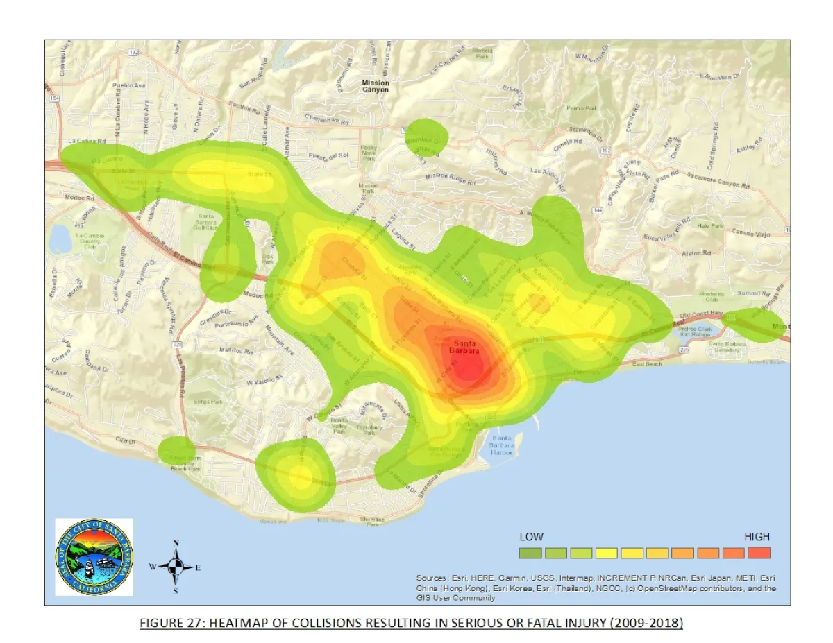
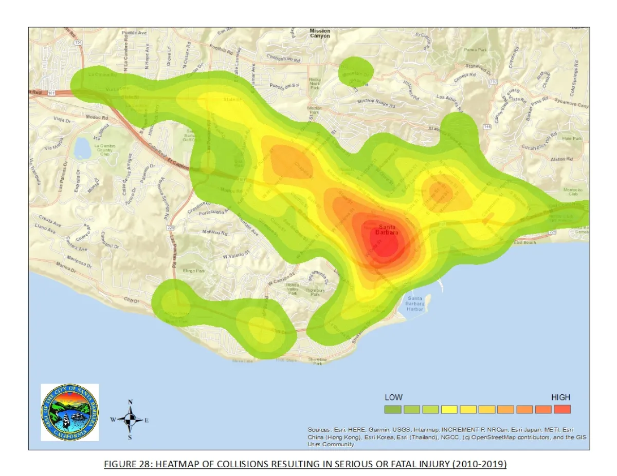
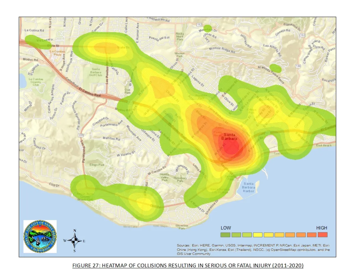
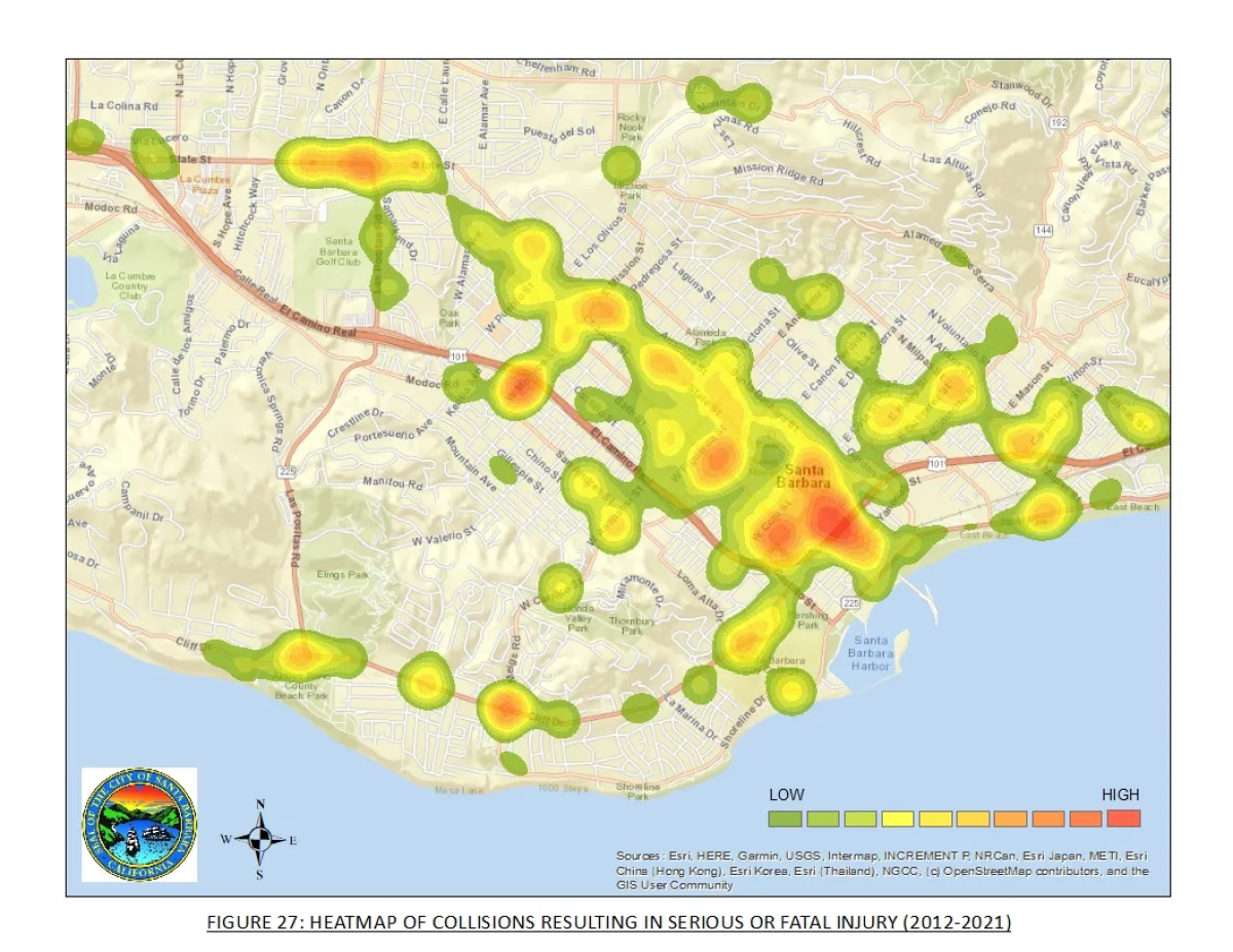
The Serious and Fatal Collisions Heat Maps show the locations of all collisions resulting in serious injuries and fatalities over a ten-year period. The areas in red have the highest numbers of collisions, whereas the yellow and green represent lower numbers. The data represented and community feedback from the collision prone areas help City staff develop approaches to cool the maps over time, thus getting closer to zero fatalities and serious injuries.



Contact Us:
630 Garden Street, Santa Barbara, CA 93101
VisionZero@SantaBarbaraCA.gov
735 Anacapa Street
Santa Barbara, CA 93101
Phone: (805) 963-0611
Hours: 9:00 a.m. to 5:00 p.m., Monday - Thursday, and alternate Fridays.
City of Santa Barbara, PO Box 1990
Santa Barbara, CA 93102-1990
Sign up for one or more newsletters on many city topics
